Deciduous forest
We’ve learnt that deciduous leaves fall off in autumn in preparation of winter to minimize the amount of water loss when transpiring. It is also known that the leaves turn brown during this period. However, you may asked one question. How do the leaves turn brown?
It is because during the shorter days and cooler weather of autumn, green chlorophyll in the leaves begins to decompose, revealing orange, yellow, and red. This is because the plant has limited sunlight and water thus the leaves are unable to continue producing chlorophyll. Actually, these colors were present in the leaves all year long, but had been hidden by the green pigment of the chlorophyll.

Since there is no more chlorophyll, how do the trees survive without leaves during the winter when they cant make food?
To prepare for winter, deciduous trees and plants become dormant. They lose their leaves and seal the places where leaves were attached with a protective covering called a leaf scar. If they kept their leaves, the water in the leaves would freeze into ice, damaging the leaves and leaving the plant vulnerable to bacteria or fungi. Plants also make a concentrated sugar solution to stop water from freezing in their stems.
How does the tree know when to start growing leaves? The longer days and warmer weather of spring signal to the trees to grow new leaves and begin photosynthesis again.
Then how does the environment have an effect on such adaptation? The trees get a lot of sunlight in summer and thus are able to get energy to make food for the plant. Some food is stored in the roots for the next spring. However, when the temperature gets lower, the tree cuts off the supply of water to the leaves and seals off the area between the leaf stem and the tree trunk. This is why trees get limited supply of water and sunlight during autumn. Finally, when the temperature get warmer, the leaves then start growing back.
We also learnt examples of tress like the Oak Tree. Leaves are big and broad to increase surface area to get as much sunlight as possible in summer. However, these leaves also losses a lot of water during transpiration making then shed their leaves in the autumn.
Knowing this, I have a question I can’t seem to find the answer to. Why do the trees have such big leaves if they lose a lot of water during the winter? Is it because they need to get a lot of sunlight during the summer? However, small leaves also can capture sunlight and make food for the plant. If this is so, why is it that the plant has big leaves instead of small leaves that will help decrease the amount of water loss during the winter? If they had small leaves, won’t they be able to make food even in the winter and don’t have to stay dormant?
Many of us have seen leaves found in temperate forests and tropical forest. There is a distinct difference in leaves for both climates. Then, what effect does climate have to the edge of the leaf?


Leaves in temperate deciduous forests mostly have toothed edges but the leaves in tropical rainforest have smooth entire edges. This is because climate and leaf margin are closely tied. The leaves of tree species native to colder climates usually have more teeth cut more deeply into the leaf; they are more dissected on their edges so they have a higher perimeter-to-area ratio. The presence of a toothed edge seems to assist in unfolding young leaves from buds so they can maximize photosynthesis when breaking winter dormancy.
The forest floor grows rapidly in summer and spring and disappears during winter. Another question I couldn’t find an answer to is, why the plants on the forest floor disappear when they can get as much sunlight as they want during autumn and winter when the leaves drop and they can get a lot of sunlight? Is it because its too cold? Is it also because of water loss?
Coniferous forest
We learnt that the coniferous forest is evergreen. They have cone shaped structures to allow snow to slide off and needle-like leaves to lessen water loss. They also have supple braches don’t break easily so the tree won’t fall off because of imbalance of weight. The leaves are evergreen because they do not lose much water during transpiration as they have small surface area. Thus the leaves always stays green and does not need to fall off.

We also know that there is only one type of plant in the coniferous forest, but why is that so? Is it because not many plants cant adapt to such a climate thus resulting in low diversity?
The soil in coniferous forests is not fertile unlike the soil in temperate deciduous forest. Why?
In the deciduous forest,it is not evergreen and the leaves drop very autumn thus resulting in very fertile soil. This is also the reason why their leave litter is so thick. Remember the trip to bukit timah? The leaf litter there, a tropical rainforest is already quite thick; but the leave litter in the deciduous forest is thicker because the leaves drop more. However in coniferous forests, it is evergreen and the leaves hardly drop thus not providing any nutrients. Thus, the soil isn’t fertile.


 -
-


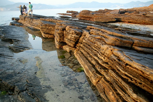
 Therefore, sometimes the two plates would get 'stuck' and lock together. But since the convection currents of the underlying magma are still dragging the plates, much tension and pressure is built up at the transform boundary. When there is sufficient buildup of pressure, rocks in the plates break and get jerked apart. This results in


