This blog is soley for educational purposes, made only for the ACE Geography girls of PLMGSS. Thank you for your kind cooperation.

Sunday, March 13, 2011

Tsunami

 The recent earthquake and tsunami in Japan has caused a lot of devastation and damage to the country. I’m very sure everyone also knows that Japan is a country that is very prone to Earthquakes. They get it so often that when an earthquake comes, they find it no big deal and would just stay very calm. However, this makes me curious as to why Japan get earthquakes, no matter big or small every year. Is it because of where their position located at? Or is it because they are just unlucky?
  
  Now back to my topic on tsunami, it is reported that “The large earthquake triggered a tsunami warning for countries all around the Pacific ocean.” It really puzzled me how and why an earthquake of such a dangerous magnitude can trigger a tsunami about 10m high. Did these two things just magically happen coincidentally? Or is it because of the impact the earthquake caused resulting in the tsunami? Then again, how are they related?

  It is said on the internet that “The Japanese archipelago is located in an area where several continental and oceanic plates meet. This is the cause of frequent earthquakes and the presence of many volcanoes and hot springs across Japan. If earthquakes occur below or close to the ocean, they may trigger tidal waves (tsunami).
  Then this answers my question ^-^
   Because of Japan’s location, they get earthquakes very easily. And because the earthquake occurred below or close to the ocean, it triggered a tsunami.
  This picture shows how a tsunami is formed. As one plate slips below another, pressure builds after many years, resulting in a section suddenly giving way. After it gives way, it ruptures the ocean floor, resulting in a massive displacement of water. As the plate snaps back, a force pushes the water up. Oscillation develops underwater at great speed. Sea water is sucked from the shore and rushes back with force. Tsunamis are barely felt on the ocean surface. As the waves reaches the land, the tsunami becomes bigger as the water becomes shallower. 
  As I'm typing this down, another question struck my mind. Why is it that tsunamis are barely felt on the ocean floor? If the pressure that builds up after many years is what determines the impact of the tsunami, then how is more pressure formed? Is it by the number of years the pressure builds thus releasing a greater force?
                                              
                                                                      ^-^The End 

Friday, March 11, 2011

Earthquake

As i've said last week:

Transform Plate Movement A transform plate movement is one where two plates slide laterally past each other. However, movement is not smooth due to friction between the rocks of the two plates. Transform Therefore, sometimes the two plates would get 'stuck' and lock together. But since the convection currents of the underlying magma are still dragging the plates, much tension and pressure is built up at the transform boundary. When there is sufficient buildup of pressure, rocks in the plates break and get jerked apart. This results in earthquakes.

As you may have heard, this afternoon a large quake struck Japan.

7.9 magnitude quake strikes Japan
A 7.9-magnitude earthquake has struck off Japan's northeastern coast, shaking buildings in Tokyo for several minutes and sending people out into the streets.
Japan's meteorological agency warns that a tsunami as high as 20 feet (6 meters) could strike the coast near Miyagi prefecture, closest to the epicenter.
The agency says the quake struck at 2:46 p.m. Friday at a depth of 6 miles (10 kilometers), about 80 miles (125 kilometers) off the eastern coast.
Several quakes had hit the same region in recent days, including a 7.3 magnitude one on Wednesday.

What is the link between GEOGRAPHY and the EARTHQUAKE that just happened?


Friday, March 4, 2011

Geography lesson on 4/3/11


Earth:


Crust - Solid
Mantle - Liquid
Core - Solid


The Plate movement:

The Plates 'floats' on the liquid mantle. As the Earth is spherical, and convection currents occur in all parts of the mantle, plates dragged away from one side will also collide on the other side. This leads to the different types of plate movements all over the Earth's surface.


Convergent Plate Movement

When two plates move towards each other, they would collide. This is called a convergent plate movement. As the plates collide, some crust is destroyed due to the impact, therefore this convergent boundary is also called a destructive boundary.

When A Continental And Oceanic Plate Collide
When a continental plate and an oceanic plate collide, subduction occurs. The oceanic plate sinks under the continental plate as it is denser. The crust carrying the ocean melts underneath at the subduction zone due to the immense friction and high heat of the magma, which is acidic with higher silican and sulphuric content.
Subduction
The impact of the collision also causes cracks to form in the crust. The heat and pressure from the mantle forces the acidic magma to rise up these cracks. As the magma continues to rise up the cracks, it escapes onto the surface and solidifies, building up a volcano. Magma on the surface is now known as lava. Thus, an acid lava volcano is formed.
The converging of the oceanic and continental plate also cause deep oceanic trenches and fold mountains to form.

When Two Continental Plates Converge
When two continental plates converge, one plate will be forced only slightly under the other, but no subduction will take place. Thus, the pressing together of two plates will fold the crust and forms what we known as fold mountains.

When Two Oceanic Plates Converge
Similarly, when one oceanic plate converge, the other oceanic plate may subduct beneath the other. However, there is no head-on collision for two oceanic plates. Magma will then rise up to form volcanoes.


Divergent Plate Movement

A divergent plate movement occurs when two plates move away from each other. Magma from the mantle underneath the crust to rise up the surface to cool and solidify at the plate boundary. This divergent boundary is considered constructive since new crust is formed.
Divergent takes place at the boundary of the oceanic plates and forms new sea floor. This process is called sea-floor spreading.


As magma rises up to the surface, it piles up and solidifies, slowly forming a long chain of moutains on the ocean floor, called an oceanic ridge.

Volcanoes can also form undersea at these divergent boundaries, they are called submarine volcanoes and have gentle eruptions.


Transform Plate Movement

A transform plate movement is one where two plates slide laterally past each other. However, movement is not smooth due to friction between the rocks of the two plates. Transform Therefore, sometimes the two plates would get 'stuck' and lock together. But since the convection currents of the underlying magma are still dragging the plates, much tension and pressure is built up at the transform boundary. When there is sufficient buildup of pressure, rocks in the plates break and get jerked apart. This results in earthquakes.


Saturday, February 26, 2011

Earth's Layers


What are these Layer of the Earth made of?
  The outermost layer of the Earth is the crust. It is solid and comprises the continents and ocean basins. The crust has a variable thickness, being 35-70 km thick in the continents and 5-10 km thick in the ocean basins. The crust is composed mainly of alumino - silicates. 
  The mantle is liquid and composed mainly of ferro-magnesium silicates.This is where most of the internal heat of the Earth is located. Large convective cells in the mantle circulate heat and may drive plate tectonic processes.
  The outer core is liquid and is composed mainly of a nickel-iron alloy. While the solid inner core is almost entirely composed of iron. Earth's magnetic field is believed to be controlled by the liquid outer core. The outer core is 2300 km thick and the inner core is 1200 km thick.

Why is the Core Solid???
Inner core is thought to play an important role in the generation of Earth's magnetic fields by dynamo action in the liquid outer core.The existence of the inner core also changes the dynamic motions of liquid in the outer core as it grows and may help fix the magnetic field since it is expected to be a great deal more resistant to flow than the outer core liquid.

How does the Mantle Affect Us?
  Because the earth is very hot inside, a current of heat flows from the core to the crust. This is called convection current and it also takes place in the mantle. This current cools down as it comes closer to the surface of the earth. As a result, the rising of the current decreases and goes into horizontal direction along the bottom of the crust. When the current cools down more, the convection current descends again and goes to the inner earth. There the temperature increases and the current rises again. This goes on and on.
  When the current comes at a weaker part of the crust, for example at a volcano, magma comes above the earth's surface. The convection current along the bottom of the crust causes the moving of the tectonic plates. This is called plate tectonics. The movement of these plates goes very slowly. The bumping of two tectonic plates causes an earthquake.

  As I was doing my research, these three words, Asthenosphere, Mesosphere and Lithosphere came out very often so i decided to write the definition about it.
  The asthenosphere is a zone of the earth's mantle that lies beneath the lithosphere and consists of several hundred kilometers of deformable rock. It is solid rock, but  soft and flows easily (ductile).
  The lithosphere is the outer part of the earth, consisting of the crust and upper mantle, approximately 100 km (62 mi.) thick.(up to 200 km thick beneath continents, thinner beneath oceanic ridges and rift valleys), very brittle, easily fractures at low temperature.The lithosphere is comprised of both crust and part of the upper mantle.
  The mesosphere is about 2500 km thick, solid rock, but still capable of flowing.


  Also, as I was researching, these questions came out and made me really curious. Would the Earth run out of magma? If so, then what would happen and how would it affect our lives? Another question. It may sound a little unrealistic but its worth posting. What would happen if i drilled a tunnel through the center of the earth and jump into it?

                                               End of Post ^-^ 

Friday, February 18, 2011

Geography Lesson on the 18.02.11

RECAP:
We learnt about the some of characteristics of the...
- Igneous rocks
- Sedimentary rocks
- Metamorphic rocks
We did the sedimentary rocks in more detail.

Sedimentary Rocks:
- Some examples of sedimentary rocks are conglomerate, limestone and shale.
- They have very obvious layers.
- They are broken down very easily, especially limestone.
- The sedimentary rock covers of the continents of the Earth's crust is extensive, but the total contribution of sedimentary rocks is estimated to be only 5% of the total volume of the crust, much less then the igneous rocks and the metamorphic rocks.
- Sedimentary rocks are deposited in layers as strata, forming a structure called bedding.

How are the Sedimentary Rocks formed?
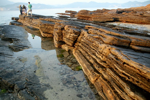
The sediments are deposited and they pile up in layers, with the weight of more layers piling up, the sediments will cament together and harden, forming the sedimentary rock.

I find this website diificult to understand as it is very profound. They call it a 'A Basic Sedimentary Rock Classification' but i dont understand it. But still, its about sedimentary rocks:) You can visit it if you have the time: http://csmres.jmu.edu/geollab/fichter/SedRx/sedclass.html

Some pictures of Sedimentary rocks:):)


Saturday, February 12, 2011

11/02/11 lesson recap

What we have learnt this week:

1) Scales
Atlas -> Book of Maps -> Location -> Scales

  • There are both large scales and small scales.

2)  Land Mass
World (International)   
Region                             
Continents
Countries
Cities
Towns
Community/ Village

3) Oceans
  • Pacific Ocean ( America & Asia)
  • Atlantic Ocean ( Africa & South America)
  • Indian Ocean ( Below India)
  • Southern Ocean ( Above Antarctica)
  • Arctic Ocean (Above Europe)

4) Fragile Earth
 The interrelationship between physical Earth and the human environment

Human actions causes  -> Impact on environment -> Manage the impact

5) Physical Environment (Rocks)
  • Rocks are small scale
  • Landforms are large scale
How are they linked?
  • Rocks make up massive landforms.
What are rocks?
  • Rocks are solid materials on the Earth’s crust
  • Made up of minerals like Quartz and Sand

                                                   End of Recap^-^

Saturday, January 29, 2011

Longtitudes and Latitudes

What did we learn in the previous lesson? We learnt about the longtitudes<vertical lines> and latitudes<horizontal lines>.

Longtitude:
-Greenwich Meredian, also known as the Prime Meredian(0degree)
Latitudes:
-Arctic Center(66.5degreess N)
-Tropic of Cancer(23.5degrees N)
-Equator(0degrees)
-Tropic of Capricorn(23.5degrees S)
-Antarctic Circle(66.5degrees S)


~END OF RECAP~

Thank you. Corinne and Alison:)